The PSF Citizen Science program began in 2015 as a partnership between the Pacific Salmon Foundation, Fisheries and Oceans Canada, and Ocean Networks Canada (ONC). The brainchild of Dr. Eddy Carmack – a retired scientist from the Institute of Ocean Sciences, DFO – it involves volunteers using a “mosquito fleet” of their own fishing vessels to do oceanographic surveys in overlapping areas of the Strait of Georgia approximately every two weeks.
An instrument is lowered through the water to collect and store electronic measurements of conductivity, temperature and depth (CTD). Conductivity values can be used to calculate salinity. Two auxiliary sensors are also used to measure fluorescence (an indicator of plankton productivity and algal growth) and oxygen content (which helps trace the movement and flushing of water). All this information is then transmitted using a custom designed smart phone application and uploaded to an oceanographic data management system (at the University of Victoria), where the data are checked and then archived. The data are freely available to anyone once they have been verified and archived.
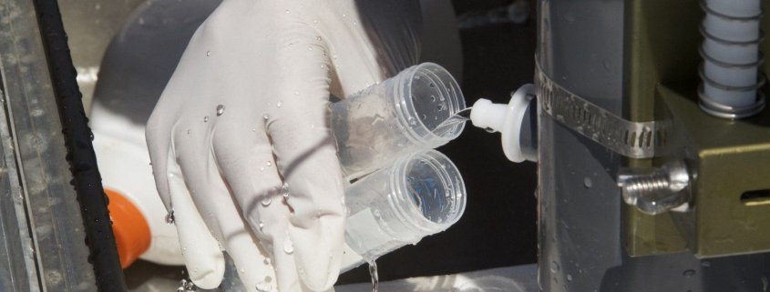
Four other elements of the work are done by hand to assess water quality. Water samples are taken for nutrient analysis, phytoplankton and zooplankton samples are collected, and turbidity is measured. Nutrients can be limiting factors in plankton growth, while low turbidity is an indicator of healthy water. Plankton is analyzed for occurrence of harmful algae blooms, as well as the nature of the base of the food chain for salmon.
In one day, these citizen scientists collect data and water samples from more than 100 sites with automatic transmission of the data via a mobile app called Community Fishers. The app, developed by ONC, allows fishers and volunteer citizens to upload the oceanographic data to ONC’s world-leading data management system, Oceans 2.0. From there, the data are archived, processed and visualized for scientists and the public around the world. All the data are ultimately stored in the PSF-UBC Strait of Georgia Data Centre, where they are freely available to the public. The Data Centre also creates outreach products about these data, some examples include: a story map; maps of harmful algae distribution; a complete digital Atlas that was developed by Dr. Rich Pawlowicz and students at UBC, hosted on the Data Centre; and several newsletters (sent as attachments and posted here).

Why it’s important
Collecting oceanographic measurements this way allows us to be “everywhere at once” (well within a day at least) and make accurate, consistent data comparisons like never before. Dedicated and trained local citizens are also significant in this era of over-committed staff and shrinking budgets. Finally, the data will help us better understand what is impacting the survival of Pacific salmon in our local waters.
This collaborative program is now continuing for a ninth year, providing oceanographic information at a temporal and spatial scale not achievable with large traditional research vessels. The data collected are allowing us to assess annual variation in physical/chemical oceanography, develop ecosystem models, validate satellite imagery, and understand spatial and temporal changes in productivity of the Strait of Georgia.
See this flyer for more information about the program, its value and uses of the data. We’d also love to hear feedback on how this program can best meet the needs of researchers studying the Strait of Georgia, please fill out this short survey.
Citizen Science Data Analysis
The first peer-reviewed paper based on data collected by the Citizen Science Oceanography program was published in 2021 – “Harmful Algae and Oceanographic Conditions in the Strait of Georgia, Canada Based on Citizen Science Monitoring”
This work revealed frequent presence of harmful algal blooms (HABs) in the Strait, their pronounced spatio-temporal variations and links to environmental drivers. It also showed that there are more negative effects in aquaculture in years that HABs are more prevalent. Data collected during this study can be combined with higher trophic level data (e.g., zooplankton and fish) to further analyze interactions among physical oceanographic parameters, food web dynamics, and potential outcomes for fish stocks. Together, this information can aid in our understanding of the relationships between Strait of Georgia conditions and the survival and growth of the juvenile fish that are of cultural and economic importance in the region. See this peer-reviewed article Indications that algal blooms may affect wild salmon in a similar way as farmed salmon by our researchers and partners to learn about how HABs affect wild salmon in Cowichan Bay.
Explore more of the findings in this slide deck presented at the 2022 Salish Sea Ecosystem Conference:

Another example of a researchers putting the citizen science data collected in this program to use is the following paper also published in 2021: A Study of Intermediate Water Circulation in the Strait of Georgia Using Tracer-Based, Eulerian, and Lagrangian Methods. This study aimed to identify circulation pathways to better understand the movement of contaminants through the Strait of Georgia. While multiple data sources were drawn on for the analysis, Pacific Salmon Foundation’s Citizen Science Oceanography Program’s comprehensive data set was foundational for the work.
Data from the PSF Citizen Science Oceanography Program is also being used to explored for linkages between juvenile salmon, oceanographic conditions, and lower trophic levels in the Strait of Georgia. Watch PSF Biologist Svetlana Esenkulova present on the ecosystem dynamics of juvenile Salmon in the Strait of Georgia for the 2022 Salish Sea Ecosystem Conference:

For updates about the Citizen Science Oceanography project, check out recent newsletters.

Curious of how it is done? Here is the Citizen Science Oceanography Sampling Manual.
